
User login
Language
Anonymous's groups in this site
User is not a member of any group.
Your groups across all your sites
User is not a member of any group.
Recent Content
Recent Comments
- United Health advancec over $2 billion to hacking victims 4 weeks 1 day ago
- Charts show how flu, COVID and RSV have spread in the U.S. 4 weeks 1 day ago
- Congressional funding resources cutbacks likely 2 months 2 weeks ago
- Also see: additional article on possible tests for long Covid 2 months 4 weeks ago
Who's online
There are currently 0 users online.
You are here
More Than 40 Sites Released Hazardous Pollutants Because of Hurricane Harvey
Primary tabs
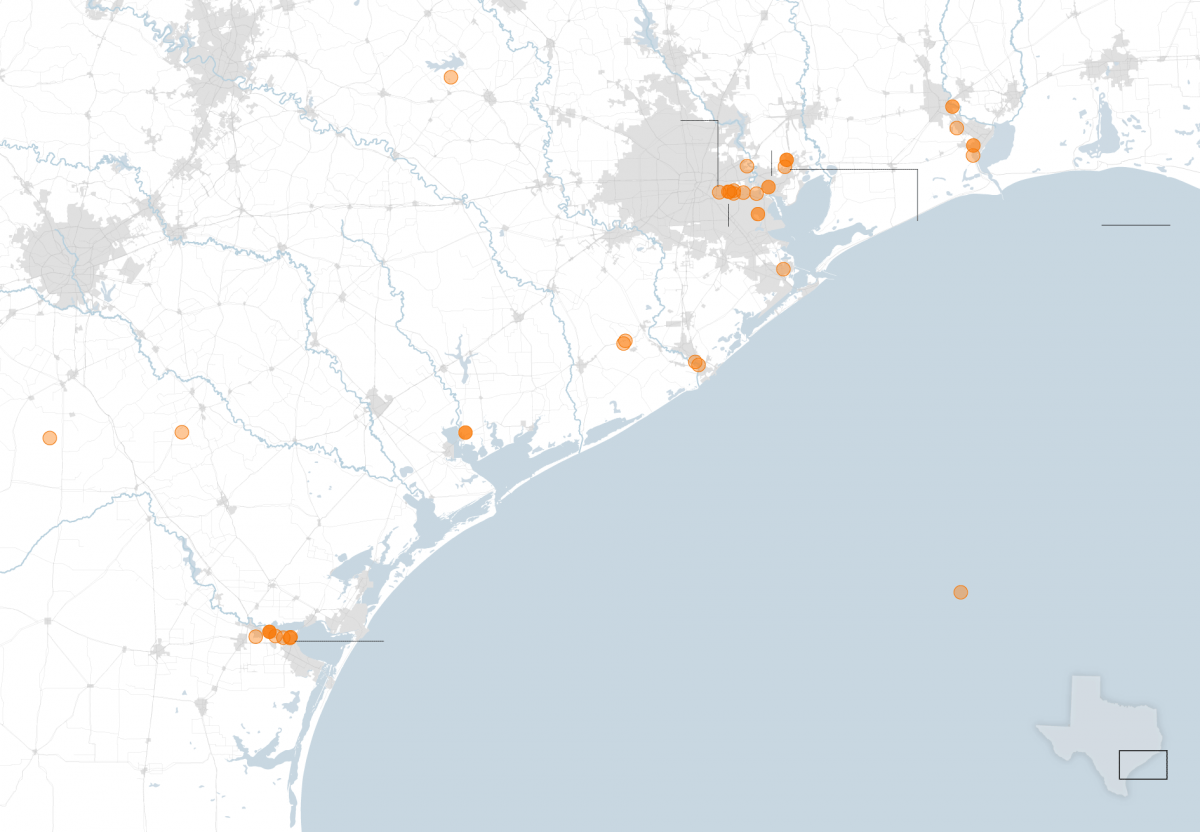
Image: Map of Houston area and potential leak sites. Estimated data from Aug. 23 to Aug. 30, 2017
nytimes.com - Troy Griggs, Andrew W. Lehren, Nadja Popovich, Anjali Singhvi, Hiroko Tabuchi - September 8th 2017
Houston’s sprawling network of petrochemical plants and refineries released millions of pounds of pollutants in the days after Hurricane Harvey began barreling toward Texas.
Even under normal operations, the hundreds of industrial facilities in the area can emit harmful chemicals. But from Aug. 23 to Aug. 30, 46 facilities in 13 counties reported an estimated 4.6 million pounds of airborne emissions that exceeded state limits, an analysis by the Environmental Defense Fund, Air Alliance Houston and Public Citizen shows.


Comments
Harvey Swept Hazardous Mercury Ashore. The Mystery: Its Source.
A related article from NYT: https://www.nytimes.com/2017/09/06/science/harvey-superfund-mercury.html